- Home
- Administration
- Aeronautics
- Business with WYDOT
- Construction Projects
- Driver License and Records
- Economic Stimulus Projects (ARRA - TIGER)
- Engineering and Technical Programs
- Fuel Tax
- Highway Safety
- Human Resources
- Manuals and Publications
- News and Information
- Permits
- Planning/Projects/Research
- Titles, Plates and Registration
- Travel
- Trucking / Commercial Vehicles
- Vehicle Business Regulation
- Wyoming Highway Patrol
- Search
- Sitemap

Media Kits
WYDOT Media Kits
WYDOT will publish media kits here as available.
WYDOT gives full permission for media outlets to use the photo, video, text and other media included in media kits hosted on this webpage in their reporting. Please credit all media to WYDOT.
Reporters: have questions? Please call 307-777-4381
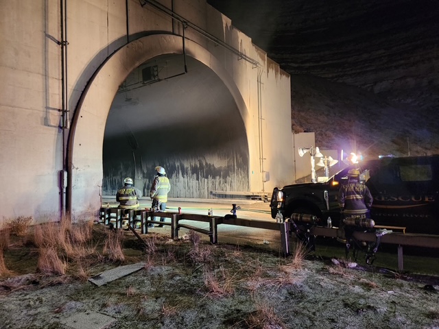
I-80 Green River Tunnel crash media kit available now!
The I-80 Green River Tunnel crash occurred Feb. 14, 2025. Click here for the media kit.
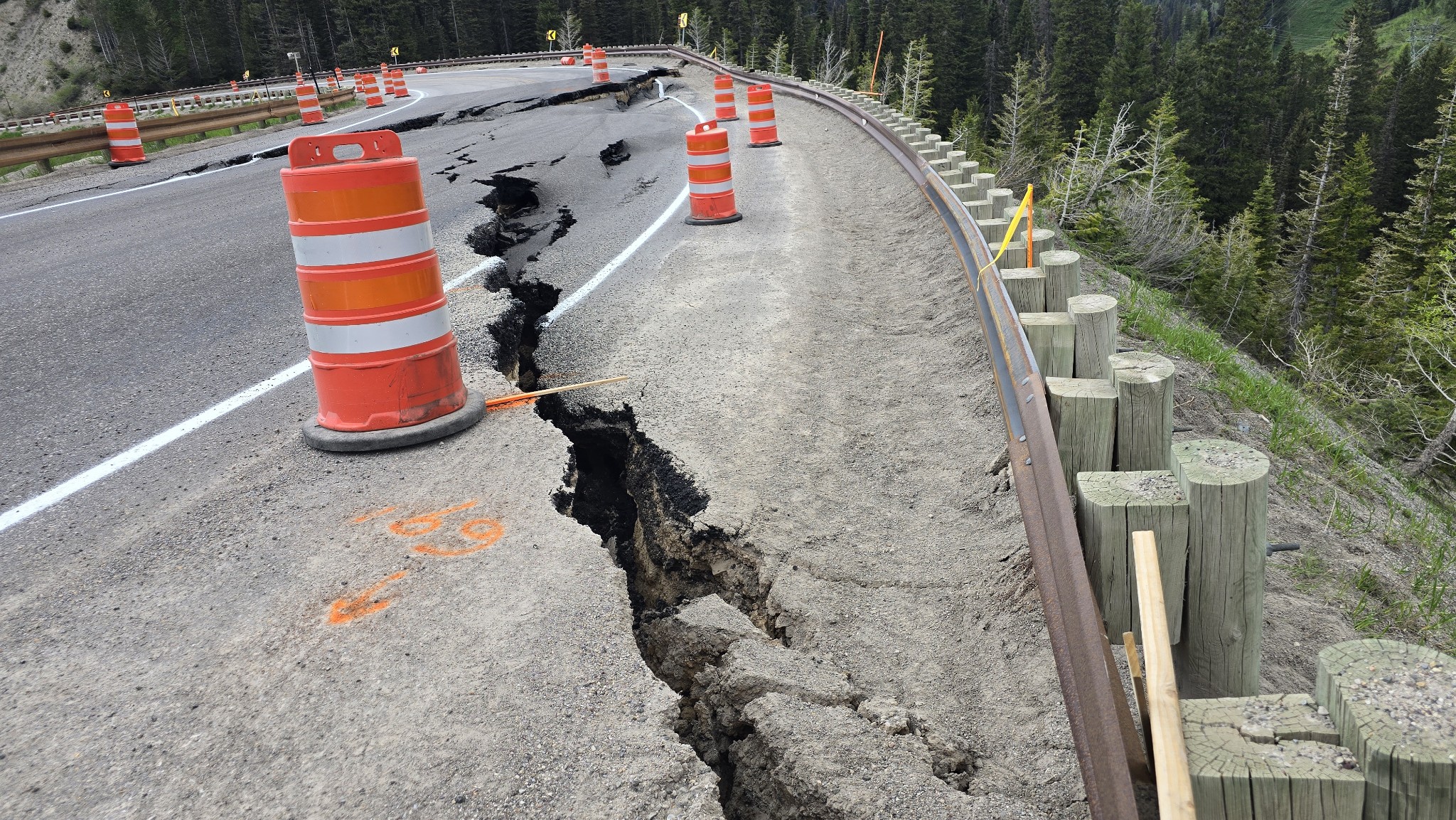
Teton Pass collapse media kit still available